Subject: North America, Texas
Period: 1838 (dated)
Publication:
Color: Hand Color
Size:
24.8 x 36.1 inches
63 x 91.7 cm
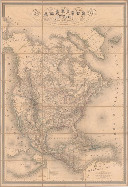
This large and handsome map of North America extends to include Central America, the West Indies, Greenland, Iceland, and a bit of Asia. It is based largely on Brue's map of 1834 with some of the best western cartography of the period. Texas is shown as a Republic in its smaller configuration along the Nueces River, with many early towns, forts and settlements depicted. Mexico is still in control of California and the present-day Southwest. In the Pacific Northwest, the United States-Canadian border is left undefined, likely a reflection of the Oregon boundary dispute. A large inset map details Alaska and the Aleutian Islands. Extensive information is noted in the various Indian districts. This is one of the more interesting large-scale maps of the pre-Fremont, post-Lewis & Clark era. Dissected and backed with contemporary linen with panel title label on verso.
References: cf. Wheat (TMW) #415.
Condition: B+
Contemporary outline color on a lightly toned sheet. Dissected and backed with contemporary linen with panel title label on verso.


