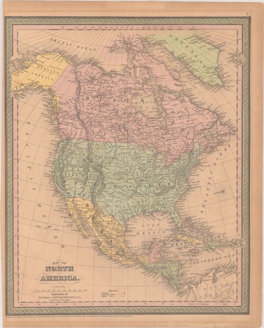
Subject: North America
Period: 1847-50 (dated)
Publication:
Color: Hand Color
A. North America, by Samuel Augustus Mitchell, dated 1847 (12.8 x 15.6"). Great transitional map showing political boundaries within that short time period after the Oregon Boundary Dispute settlement and just prior to the resolution of the Mexican-American War. Texas and Oregon Territory are part of the United States, but Mexico owns all of the Southwest. This example registered by H.N. Burroughs in 1846, with Mitchell's imprint below the title and dated 1847. Condition: Contemporary color on a lightly toned sheet with minor scattered foxing and mat burn outside of the image. Remnants of hinge tape along top edge of the sheet on recto.
B. Map of North America, by Thomas, Cowperthwait & Co., dated 1850 (12.9 x 15.7"). This fine steel-engraved map features early western territorial borders, the pre-Gadsden boundary with Mexico, and Alaska as Russian America. A large Missouri Territory extends from Indian Territory to Canada. In the west are the state of California, Oregon Territory, and the newly organized Utah and New Mexico territories (both of which were established by the Compromise of 1850). Canada is here called Ruperts Land. Good detail throughout including Mexico and Central America. Condition: Contemporary color on a lightly toned sheet with mat burn outside of the image, minor soiling, and a narrow left margin.
References:
Condition: B+
See description above.


