Subject: Colonial Eastern United States & Canada
Period: 1763 (published)
Publication: Gentleman's Magazine
Color: Black & White
Size:
9.3 x 8 inches
23.6 x 20.3 cm
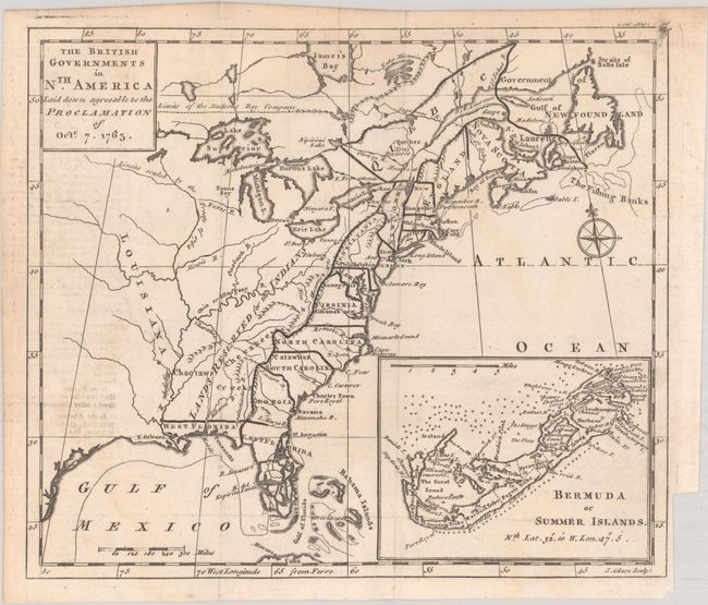
This great map was designed to illustrate the new boundaries established at the end of the French and Indian War when England came into possession of the former French and Spanish settlements in Canada and Florida. It covers the east coast from Newfoundland down the coast to East and West Florida and the Bahamas, and extends inland to include the Great Lakes and French Louisiana. The large Lands Reserved for the Indians lies west of the Appalachians. Each colony is shown with a wide engraved line. A large inset at bottom right illustrates Bermuda or Summer Islands. A compass rose capped with a fleur-de-lis decorates the strong engraving.
References: Fite & Freeman #55; Jolly #GENT-170; McCorkle #763.3; Sellers & Van Ee #110.
Condition: B+
A nice impression, issued folding with minor soiling, light offsetting from an opposing page of text, and a binding trim at bottom right.