Subject: United States
Period: 1853 (dated)
Publication: Smith's Quarto Geography
Color: Hand Color
A nice pair of 19th-century school atlas maps showing short-lived territorial boundaries.
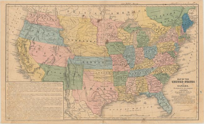
A. Map of the United States and Canada. Designed to Accompany Smith's Geography for Schools (17.8 x 10.7"). A great school atlas map with full contemporary hand coloring to delineate the early territorial borders in the west. The territories of Washington and Oregon extend to the Continental Divide, while Utah is a huge area that extends from California to the Continental Divide. New Mexico Territory occupies all of today's Arizona and part of Colorado and the border with Mexico is along the Gila River. A huge Nebraska Territory extends between the Continental Divide and Minnesota and is bounded by Canada and Kansas. A large Gold Region is shown in north central California. Most states and territories are labeled with their population. Large panel at lower left is a teacher's aid with questions. The verso contains a small map of eastern Canada. Condition: Contemporary color with minor staining, light creasing in the corners, and an archivally repaired centerfold separation at bottom. There are a few pencil marks in the image and ink notations above the top border. (B)
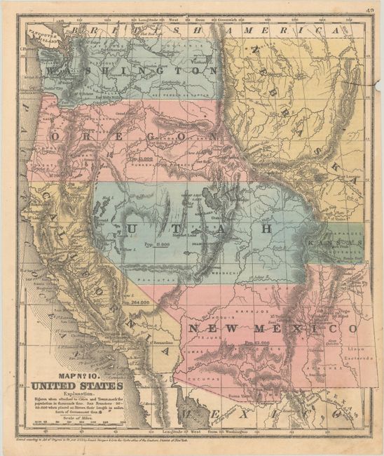
B. Map No. 10 United States (9.1 x 10.5"). A nice map of the West that displays early territorial boundaries. New Mexico Territory is shown with the post-Gadsden Purchase border plus the northern extension into today's Colorado. Oregon and Washington extend to the Continental Divide and a huge Nebraska occupies the area to the east with a small area east of Utah labeled Kansas. The large Utah Territory extends to the Continental Divide. Each state/territory is labeled with their population: Utah 11,000; New Mexico 62,000; Oregon 13,000; California 264,000. Numerous Indian tribes and military fort are located. Condition: Contemporary color with minor creasing in the bottom corners. There is a small chip in the right blank margin and small ink line extending to its left. (B+)
References:
Condition:
See description above.