Subject: United States, Aviation
Period: 1923 (published)
Publication:
Color: Printed Color
Size:
40.3 x 26 inches
102.4 x 66 cm
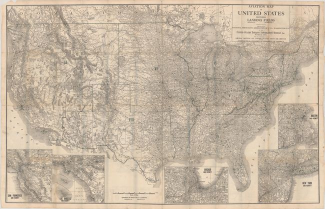
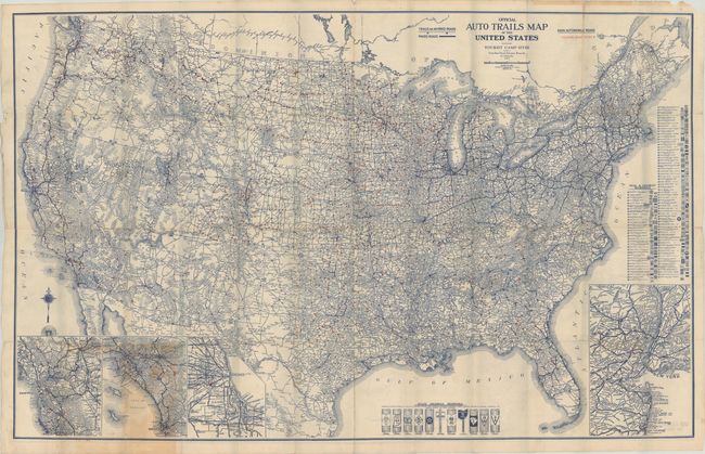
This is a scarce and early aviation map of the United States. James Akerman in Cartographics of Travel and Navigation (The Kenneth Nebenzahl, Jr., Lectures in the History of Cartography), page 237, describes the map: "Using data collected by [U.S. Air Service] Rand, McNally published its first aviation map of the U.S. in April, 1923. More than 3,000 landing fields are shown by dot symbols…" In addition to these landing sites, the states are divided into nine districts as indicated in Roman numerals, but there is no explanation of these regions. Five large inset maps illustrate major cities: San Francisco, Los Angeles, Chicago, New York, and Boston. The map was created by the United States Touring Information Bureau (TIB), Waterloo, Iowa with the cooperation of the Airway Section of the United States Army Air Service and the Aeronautical Chamber of Commerce of America. On the verso is the colorful U.S. Auto Trails Map with Tours and Camp Sites.
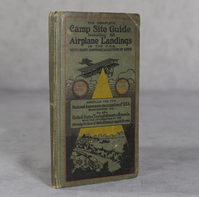
This is the first aviation map produced by the Rand, McNally Company and is complete with its original Complete Camp Site Guide, which includes a pocket at the rear to store and protect the map. The 115-page guide lists all camp grounds and landing sites. 12mo, hardbound in green cloth-covered boards with illustration on front cover.
For a similar pioneering effort relating to automobile road maps by TIB, see the previous lot (116).
References:
Condition: B
The folding map has numerous separations (0.5" - 2") around the fold junctions and a 3.5" separation along the right edge of the aviation map. Accompanying text is lightly toned. Covers have some light soiling and bumped corners.