Catalog Archive
Auction 202, Lot 131
"[Map with Report] Map Showing the Line of the Norfolk and Western and Shenandoah Valley Railroads and Their Connection... [with] First Annual Report of the President and Directors of the Norfolk & Western Railroad Company...", Colton, G.W. & C.B.
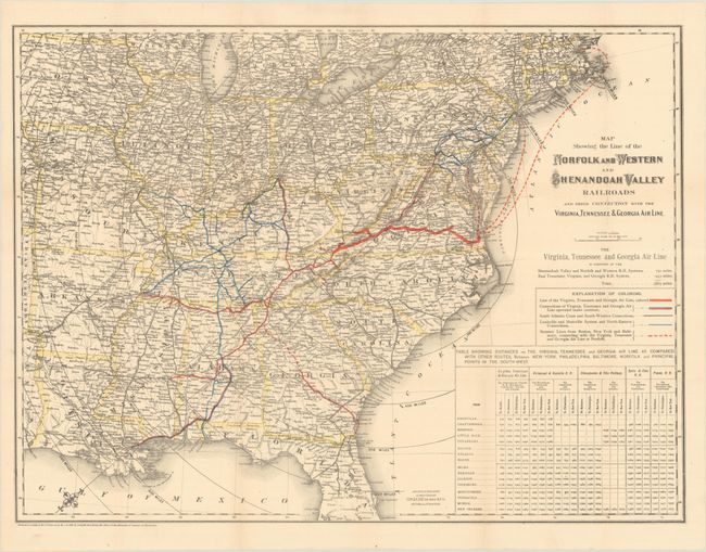
Subject: Eastern United States
Period: 1881 (published)
Publication:
Color: Hand Color
Size:
25.8 x 19.2 inches
65.5 x 48.8 cm
Download High Resolution Image
(or just click on image to launch the Zoom viewer)
(or just click on image to launch the Zoom viewer)