Catalog Archive
Auction 202, Lot 136

"New England, New York, New Jersey, and Pensilvania &c.", Moll, Herman

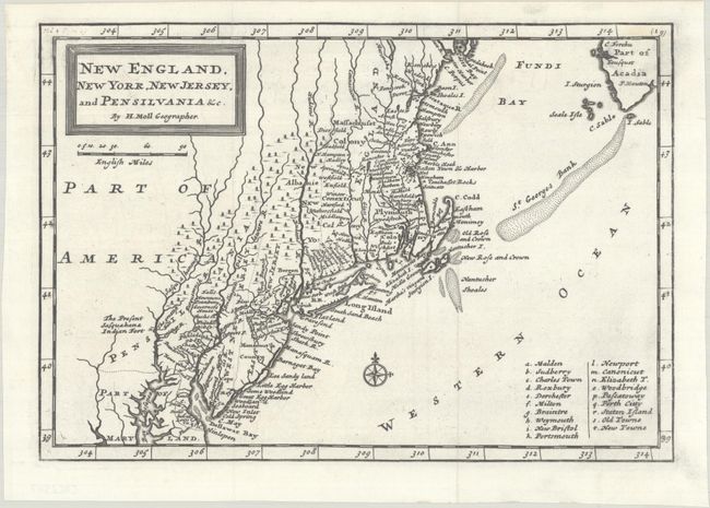
Subject: Colonial New England & Mid-Atlantic United States

Period: 1708 (circa)

Publication:

Color: Black & White

Size:
10.3 x 7.1 inches
26.2 x 18 cm
Download High Resolution Image
(or just click on image to launch the Zoom viewer)

First state of Herman Moll's earliest map of New England with great early colonial detail throughout. New York is confined to a narrow strip along the Hudson River, and New Jersey is divided into East and West New Jersey. The coastal area from Casco Bay to Chesapeake Bay is full of detail with a multitude of place names. The Massachusetts and Plymouth colonies are noted, as well as the location of the Sasqahana Indian Fort.

References: McCorkle #708.1.

Condition: A

A crisp impression on a bright sheet. Issued folding.

Estimate: $400 - $475

Sold for: $300

Closed on 2/12/2025

Archived