Catalog Archive
Auction 202, Lot 138
"A New and Accurate Map of New Jersey, Pensilvania, New York and New England, with the Adjacent Countries Drawn from Surveys, Assisted by the Most Approved Modern Maps & Charts, and Regulated by Astronomical Observations", Bowen, Emanuel
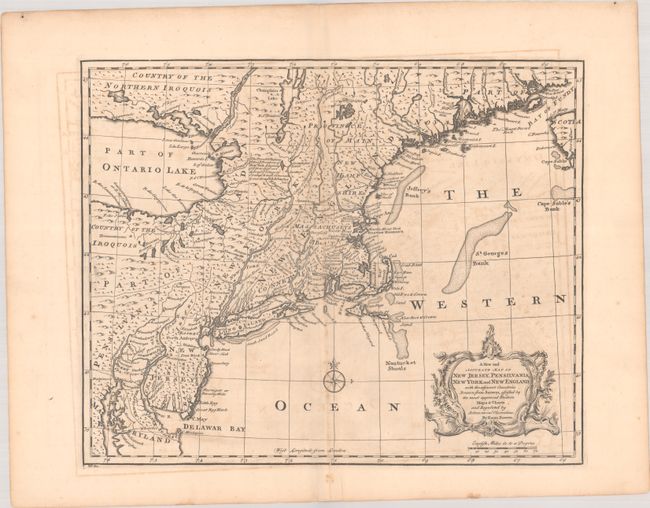
Subject: Colonial New England & Mid-Atlantic United States
Period: 1747 (circa)
Publication: A Complete System of Geography…
Color: Black & White
Size:
17 x 13.8 inches
43.2 x 35.1 cm
Download High Resolution Image
(or just click on image to launch the Zoom viewer)
(or just click on image to launch the Zoom viewer)