Catalog Archive
Auction 202, Lot 139

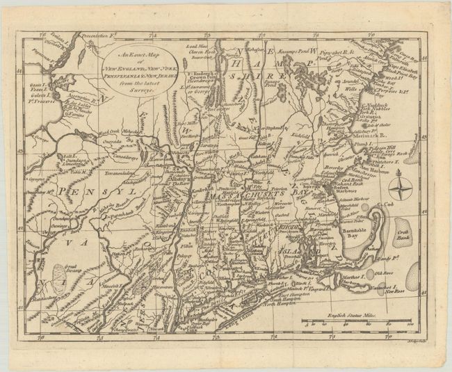
"An Exact Map of New England, New York, Pensylvania & New Jersey, from the Latest Surveys", Lodge, John

Subject: Colonial New England & Mid-Atlantic United States

Period: 1777 (published)

Publication: English Magazine

Color: Black & White

Size:
10.1 x 7.6 inches
25.7 x 19.3 cm
Download High Resolution Image
(or just click on image to launch the Zoom viewer)

A scarce Revolutionary War-period map focused on the Northeast from Pennsylvania to New Hampshire, centered on the Hudson and Connecticut rivers. New Hampshire extends to Lake Champlain and Pennsylvania's northern border is about a degree further north than its present boundary. A number of important forts are identified along the Hudson River and Lake Champlain, including Edward, Miller, George and Frederick. Indian settlements, identified by small triangles, are located primarily to the west of the Hudson River. This map appeared in the December 1777 issue of English Magazine.

References:

Condition: A

A nice impression on a clean sheet, issued folding.

Estimate: $400 - $475

Unsold

Closed on 2/12/2025

Archived