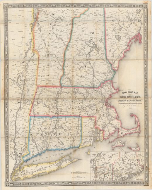
Subject: New England United States
Period: 1850 (dated)
Publication:
Color: Hand Color
Size:
19 x 23.7 inches
48.3 x 60.2 cm
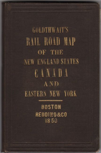
An uncommon pocket map extending from Long Island northward to southern Maine, and westward to Lake Champlain. The emphasis of the map is on the evolving railroad network in the region, with all stations named. A legend at bottom further identifies "Railroads completed, located and in progress." At lower right is an inset of the northern sections of Vermont, New Hampshire and Maine. Surrounded by a decorative border. The map is laid into brown cloth boards with gilt title on the front cover (3.4 x 5.2").
References:
Condition: B+
Issued folding on thin banknote-style paper with contemporary outline color. There is some minor foxing and several short fold separations that have been closed on verso with archival tape. Covers have minor wear.