Subject: World
Period: 1744 (dated)
Publication: Nieuwe en Beknopte Hand Atlas
Color: Hand Color
Size:
16.8 x 13 inches
42.7 x 33 cm
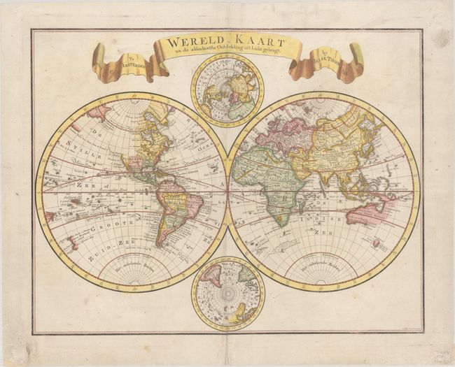
Handsome double hemisphere map with polar projections tucked between the spheres at the top and bottom. The Western Hemisphere shows the entire Northwest coast of North America blank with only the western shore of New Zealand mapped. In the Eastern Hemisphere, Nieuw Holland is shown for Australia with only the northern and western coastlines, which are connected to New Guinea. Tasmania (Van Diemens Land) is shown just below with several place names. The map is titled with a large, ribbon-style cartouche. Engraved by C. Sepp.
References:
Condition: B+
A crisp impression on a bright sheet with the watermarks of a Strasbourg Lily and "JH & Zoonen" and light soiling. There are archival repairs to a few tiny tears along the edges of the sheet and centerfold separations at top and bottom, with a minor amount of the image replaced in facsimile.