Subject: Potomac River
Period: 1946 (circa)
Publication:
Color: Printed Color
Size:
15.8 x 8.7 inches
40.1 x 22.1 cm
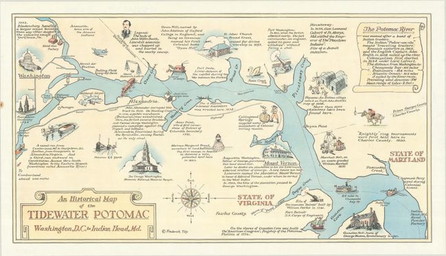
This historical map by Frederick Tilp follows the course of the Potomac River from Georgetown south to Indian Head, Maryland with north oriented to the left. It is filled with small illustrations and notations highlighting historical events, points of interest, and natural features. Illustrations include Georgetown University, Naval Gun Factory, Bolling Field, St. John's Church, Mount Vernon, Gunston Hall, and more. A note at upper right explains that Potomac comes from the Indian "Patow-om-eke" which means "travelling traders." Decorated by an architectural title cartouche, scroll explanatory note, and compass rose.
References:
Condition: A
On a clean bright sheet. There is a small rust spot in the left blank margin.