Catalog Archive
Auction 202, Lot 167
Uncommon Chart of Coastline from Savannah to Cape Canaveral
"America Septentrional. Costa Este. Hoja II. Florida y Georgia desde Cabo Canaveral Hasta Savannah Segun los Trabajos Mas Recientes de los Estados Unidos", Direccion de Hidrografia
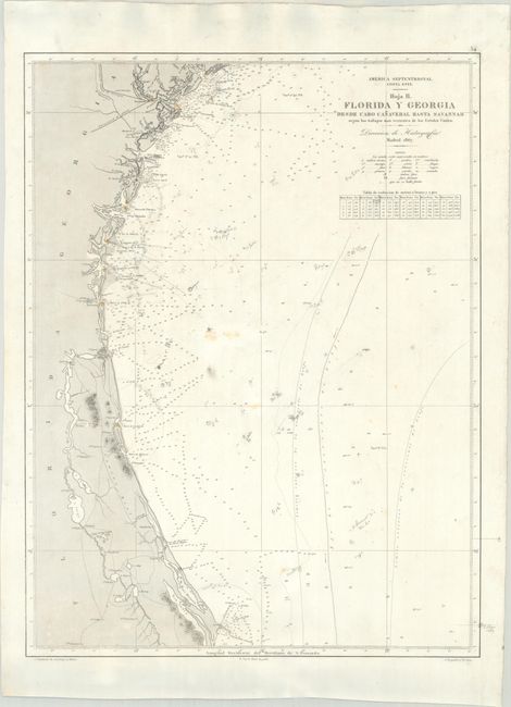
Subject: Georgia & Florida Coast
Period: 1867 (dated)
Publication:
Color: Black & White
Size:
17.5 x 23.3 inches
44.5 x 59.2 cm
Download High Resolution Image
(or just click on image to launch the Zoom viewer)
(or just click on image to launch the Zoom viewer)