Subject: Southern United States
Period: 1823 (dated)
Publication:
Color: Hand Color
Size:
24.9 x 19.5 inches
63.2 x 49.5 cm
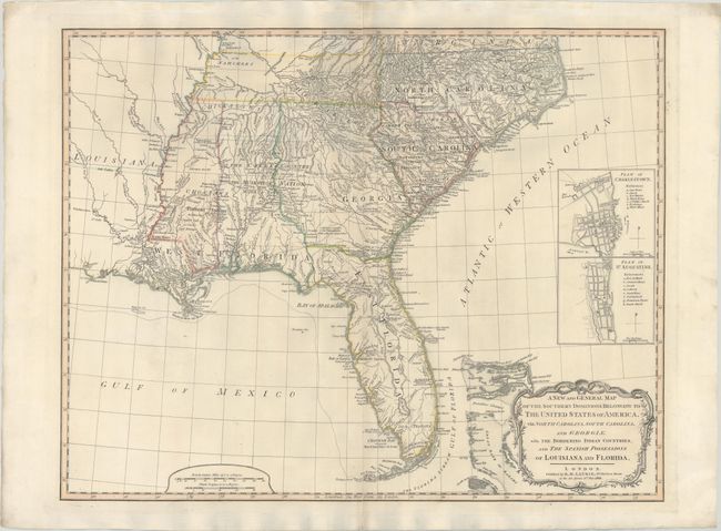
This is a later edition of this important map that was first published in 1776 in a British military atlas. It was based on the work of De Brahm, Collet, Mouzon and the important hydrographical surveys of the coast of Florida and the Bahamas by Bernard Romans. This 1823 edition has been revised to include some updates including the boundaries of an unnamed Tennessee and loose interpretations of Mississippi and Alabama territories (also unnamed). Despite these updates, Louisiana (1803) and Florida (1819) are still spelled out in the title as "Spanish Possessions." Florida is still shown divided into East & West with a spine of mountains, labeled the Great Sandy Ridge, extending down the center of the peninsula. The map is filled with information concerning Indian Nations, with numerous trails, roads and villages located. It includes inset plans of St. Augustine and Charleston above the decorative title cartouche.
References: cf. Tooley (Amer) pp. 98-9.
Condition: B+
A nice impression on "W Thomas 1818" watermarked paper with an archivally repaired 5.5" centerfold separation at bottom.