Subject: Upper Midwestern United States
Period: 1854 (dated)
Publication: A New Universal Atlas
Color: Hand Color
Size:
16.2 x 12.9 inches
41.1 x 32.8 cm
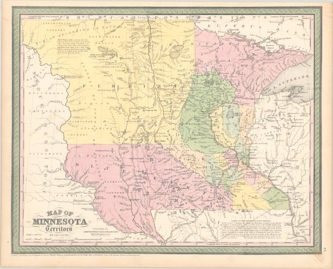
While this map bears a copyright date of 1850, it was published in 1854 with the imprint of Cowperthwait, Desilver & Butler. Development is mostly confined to the southern and eastern regions bordering the Mississippi and St. Croix rivers. The large regions to the west are labeled Pembina and Blue Earth and each is described as a "region abounding in Buffalo." The map locates many Indian tribes including the Assiniboine, Yanktonan, and Chippeway and shows the the large area recently ceded by the Dakota Indians in red outline color. Along the Missouri River a number of forts are located and named including Aux Cedres, Lookout, Pierre Choteau, Clarke, and Mandan (noted as the wintering place of Lewis and Clarke in 1804-05). Surrounded by a decorative border.
References:
Condition: A
Full contemporary color on a clean sheet with a small stain in the bottom border and tiny repaired tear in the top border.