Catalog Archive
Auction 202, Lot 179
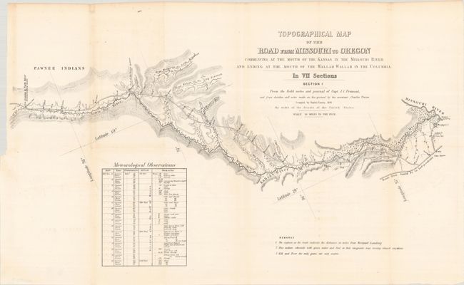
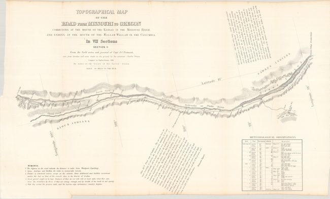
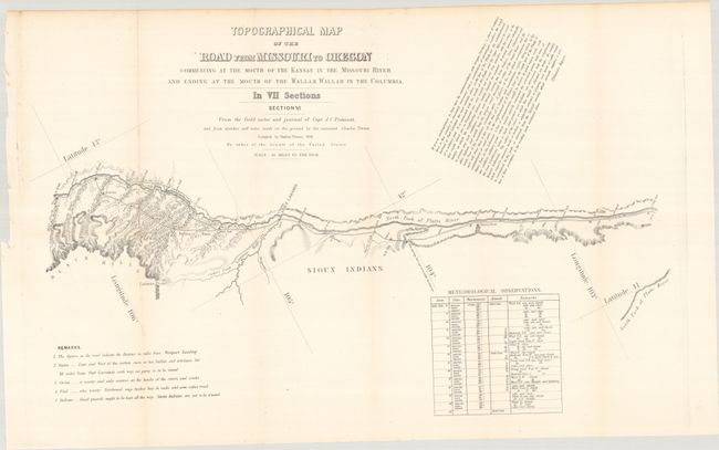
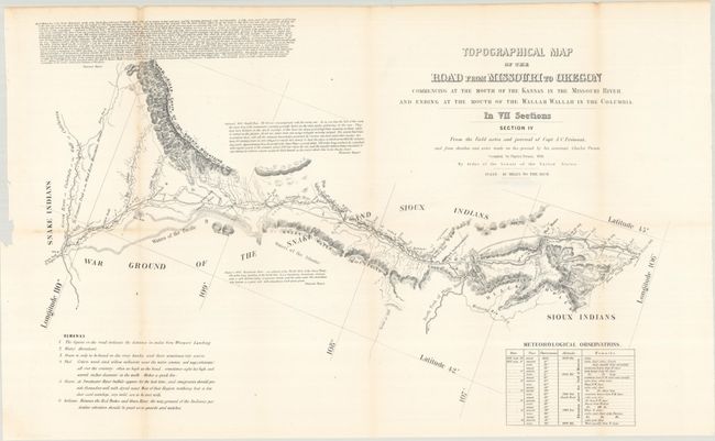
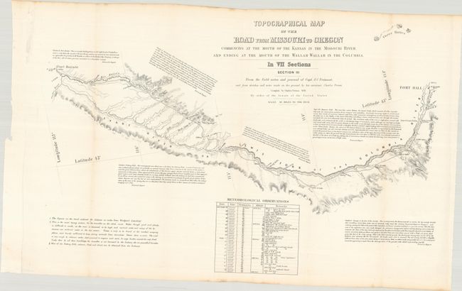
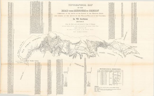
Scarce Seven-Part Oregon Trail Map
"[Lot of 7] Topographical Map of the Road from Missouri to Oregon Commencing at the Mouth of the Kansas in the Missouri River...In VII Sections... [with] Report No. 145...Canal or Railroad Between the Atlantic and Pacific Oceans", Fremont/Preuss


Subject: Western United States
Period: 1849 (published)
Publication: H.R. Report 145, 30th Congress, 2nd Session
Color: Black & White
Size:
24.5 x 12.8 inches
62.2 x 32.5 cm
Download High Resolution Image
(or just click on image to launch the Zoom viewer)
(or just click on image to launch the Zoom viewer)