Subject: Western United States
Period: 1876 (dated)
Publication: General Atlas Of The World
Color: Hand Color
Size:
25.4 x 17.4 inches
64.5 x 44.2 cm
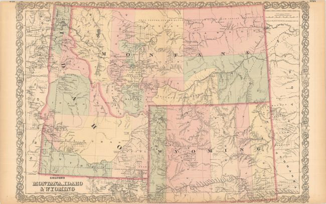
This is a handsome regional map with nice topographical detail. The map illustrates the extent of public surveying and locates settlements, Indian reservations, railroads, mining communities, forts, and more. Wyoming is shown with its original five counties along with the newly established Yellowstone National Park (1872). Montana has 12 counties with Virginia City noted as capital. The total population of these vast territories was approximately 70,000 at the time.
References:
Condition: B+
Contemporary color with light toning along the sheet edges. There is a short centerfold separation at bottom along with two tiny edge tears that have all been repaired on verso with archival tape.