Catalog Archive
Auction 202, Lot 182
"[Map in Book] Map Showing Indian Reservations in the United States West of the 83rd Meridian and Number of Indians Belonging Thereto 1879 [in] Annual Report of the Commissioner of Indian Affairs to the Secretary of the Interior for the Year 1879", U.S. Bureau of Indian Affairs
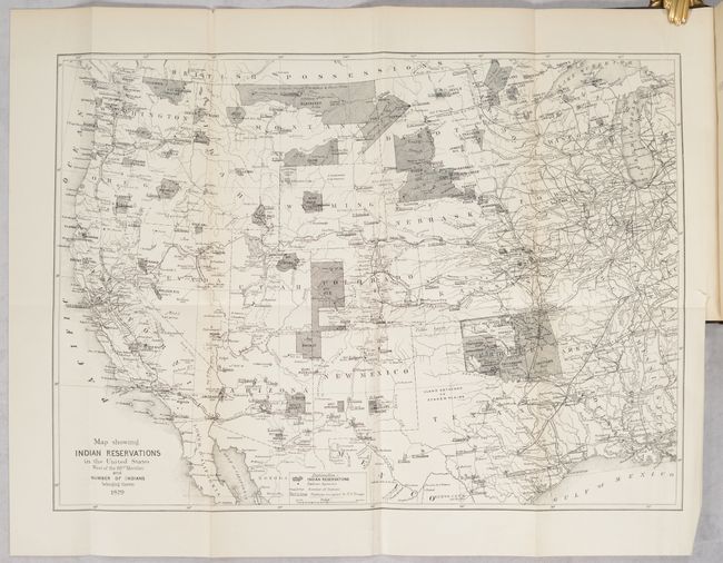
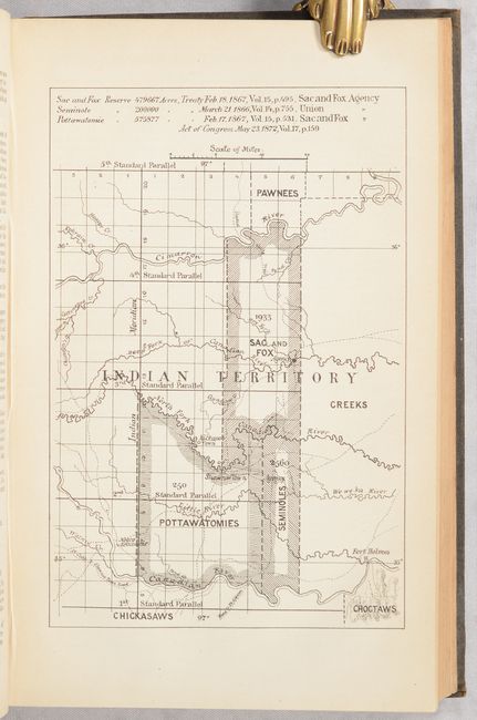

Subject: Western United States
Period: 1879 (published)
Publication:
Color: Black & White
Size:
18.1 x 13.1 inches
46 x 33.3 cm
Download High Resolution Image
(or just click on image to launch the Zoom viewer)
(or just click on image to launch the Zoom viewer)