Subject: Utah & Wyoming
Period: 1858 (published)
Publication: Sen. Doc. 11, 35th Congress, 1st Session
Color: Black & White
Size:
21.6 x 17.6 inches
54.9 x 44.7 cm
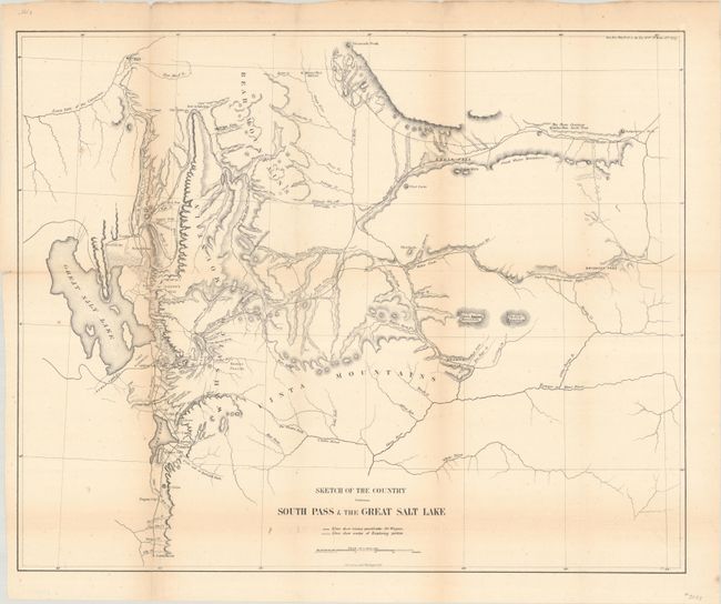
This notable map portrays the region and the emigrant routes into Salt Lake City. South Pass was the famous gateway through the central Rocky Mountains. This pass was first seen by white men in 1812, but remained largely unknown until disclosed to Jedidiah Smith by the Crow Indians. After 1832, it became the principle route for emigrants heading further west. The map shows the Mormon communities from just below Nephi to Ogden and as far north as Fort Hall, Idaho; it continues eastward to include Bridger's Pass in Wyoming, Brown's Hole, and the watershed of the Green, Uintah, and White Rivers. Marked on the map are lines showing routes practical for wagons and the routes of earlier exploring parties. Stansbury's route of 1850 is traced and labeled.
References: Wheat (TMW) #958.
Condition: B+
Issued folding with light toning along the folds, minor foxing, and a couple of short fold separations closed on verso with archival tape. There is minute loss at one fold junction.