Subject: Arizona
Period: 1896 (published)
Publication:
Color: Printed Color
Size:
17 x 20.4 inches
43.2 x 51.8 cm
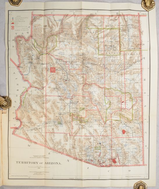
This beautifully colored and highly detailed map shows the extent of nine Indian reservations and at least four military reservations including Fort Apache. Indian reservations are outlined in green, military reservations are shown in solid red, and private claims, confirmed and unconfirmed, outlined in red. The Grand Canyon Reserve is shown. The brown hachured mountain areas and the blue waterways combine to provide great visual impact. Information includes watersheds, mountains, railroads, wagon roads, private claims, unsurveyed townships, and more. The Hopi reservation is still called the "Moqui" reservation. This edition was revised and reconstructed by R.H. Morton. A very handsome and historical map. The map is still bound in the original "Report of the Governor of Arizona to the Secretary of the Interior" (6 x 9"). Paper covers, 142 pages with text and tables describing the territory including immigration, taxation, mining, banks, railroads, and much more.
References:
Condition:
The folding map is near fine with a hint of pleasant toning (A). The text is very good, tight and clean but the paper covers have wear and lifting at the spine and a small chip at right edge on front cover (B+).