Subject: San Francisco Bay Area, California
Period: 1923 (dated)
Publication:
Color: Printed Color
Size:
15.3 x 8 inches
38.9 x 20.3 cm
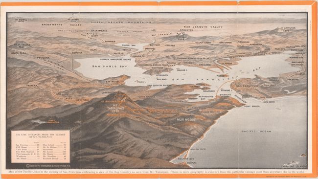
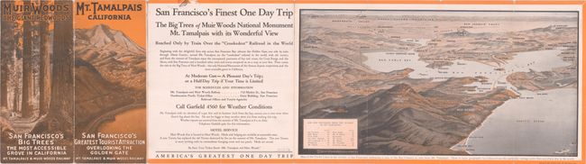
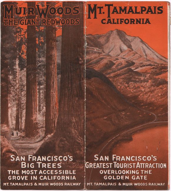
This promotional brochure promotes train service to Mt. Tamalpais and Muir Woods along the "crookedest" railroad in the world with 281 curves along the way, touting it as "America's greatest one day trip." It includes a bird's-eye view of the entire bay area from the vantage point of Mt. Tamalpais and extending out to San Jose, Sacramento, and Santa Rosa with the Sierra Nevada Mountains in the background. Produced by the Mt. Tamalpais & Muir Woods Railroad, which began operation in 1896 and closed in 1930 due in part to the growing automobile competition and the Great Depression. Self-folding into pictorial paper wrappers (4.0 x 9.0").
References:
Condition: B+
Issued folding with light wear along the fold lines and sheet edges. Archival repairs have been made to a small edge tear at top and a 2" fold separation (not in map image). There is a small printing error on verso along the top border.