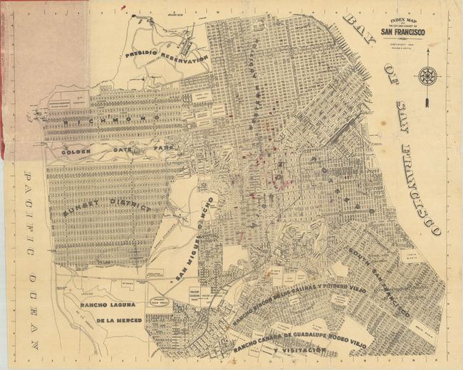
Subject: San Francisco, California
Period: 1906 (dated)
Publication:
Color: Black & White
Size:
16.8 x 13.5 inches
42.7 x 34.3 cm
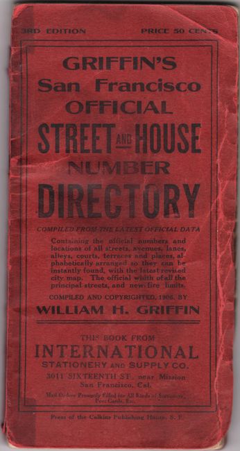
This detailed map presents the city's street grid divided into 12 districts and is bound into the back of this third edition guide. The map is accompanied by a 136-page street numbering guide, which was particularly important following the devastating earthquake that occurred only a few months prior to publication. The detailed text provides instructions for the application process to get multiple addresses for apartment buildings, where to place the numbers, and more. The "method and form of numbering" is in accordance to "Ordinance No. 31, approved by the Mayor on July 5, 1906." Also includes a section on "New Fire Limits." Red paper wrappers (3.4 x 6.7").
References:
Condition: B+
Condition code is for the folding map, which has minor foxing and some small ink marks in the image. Map is adhered to the rear wrapper which has detached. Text has some old cello tape at each tab along the fore-edge. Wrappers are soiled and worn.