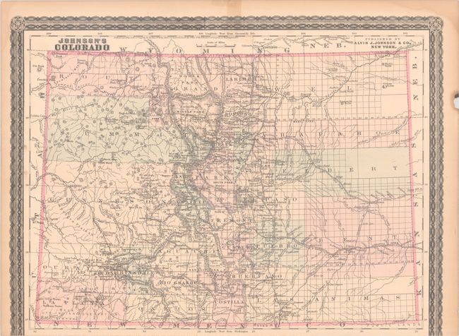
Subject: Colorado
Period: 1880 (circa)
Publication:
Color: Hand Color
Size:
17.1 x 12.7 inches
43.4 x 32.3 cm
This fine map shows the status of settlement and development only a few years after Colorado became a state (1876). It details railroads, cities, towns and mining communities, watersheds, forts, and features good topographical detail via hachuring. 31 counties are delineated and hand colored. Circa date is based upon the establishment of Chaffee County (1879) in the center of the state, but prior to Dolores County (1881) in the southwest. This single-page map was issued with a decorative border that also enclosed a single-page map of Indian Territory (not present) that opened on the adjoining page. The absence of the bottom border is therefore as issued and not a loss.
References:
Condition: B+
Contemporary color with an edge tear at top that just passes the border that has been repaired with old tape. There is some minor dampstaining and a small chip confined to the blank margins.