Subject: Florida
Period: 1840 (published)
Publication: A New Universal Atlas...
Color: Hand Color
Size:
10.9 x 12.8 inches
27.7 x 32.5 cm
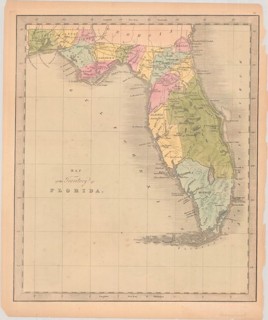
This uncommon map of Florida Territory is from the first Greenleaf edition of A New Universal Atlas. It provides an early view of county development, primarily in the northern half of the state. County configuration on this edition precedes the formation of Hillsborough County in 1834, with only the large counties of Mosquito, Alachua, and Monroe depicted in the south. Dade County, which organized in 1836, is not shown. Seminole Country is also not yet recognized on this edition. In the panhandle, a short railroad is delineated near St. Joseph's Bay, but the railroad linking Tallahassee with the Gulf of Mexico has not yet been constructed. Jeremiah Greenleaf took over the production of David Burr's New Universal Atlas when Burr was appointed Geographer of the House of Representatives in 1838.
References: Rumsey #4850.056.
Condition: B+
Full contemporary color with light foxing and toning. There are small chips and edge tears in the margins that have been closed on verso with archival tape, including two tears that extend less than an inch into map border at top and at right.