Subject: Tampa, Florida
Period: 1950 (circa)
Publication:
Color: Printed Color
Size:
11.5 x 17.6 inches
29.2 x 44.7 cm
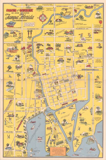
This promotional map was issued by Tampa's Convention and Tourist Bureau, highlighting the city's numerous recreational opportunities. It extends from Davis Islands north to above Hillsborough Avenue and from West Tampa east to beyond Ybor City. The map highlights the street network with vignettes filling the blank spaces including scenes of fishing, sailing, swimming, golfing, parks, important buildings, and much more. Other points of interest include Phillips Field (University of Tampa), the Fair Grounds, two cigar factories, and two "Italian clubs." Blank verso.
References:
Condition: B+
Issued folding with minor wear along the fold lines and a couple of short fold separations.