Subject: Cape Cod, Massachusetts
Period: 1926 (dated)
Publication:
Color: Printed Color
Size:
34.5 x 24 inches
87.6 x 61 cm
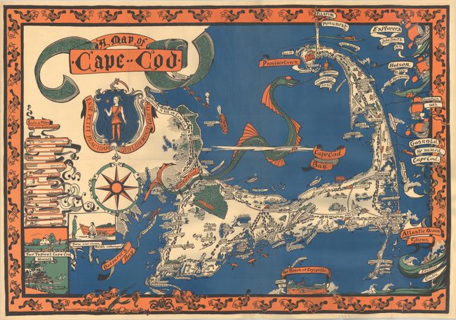
This vivid pictorial map of Cape Cod is by Melanie Elisabeth Leonard from Sandwich, Massachusetts. It highlights the Cape's many attractions with charming illustrations. A few of the sites shown are the Cape Cod Canal, which is depicted as the tail of a giant sea serpent, and the location where the Mayflower anchored. Several important historical figures are noted at right, including Captain John Smith, Henry Hudson, Samuel de Champlain, and Bartholomew Gosnold. Insets depict vignettes of Craigville beach, typical houses in Cape Cod, and a clam digger with the quote: "Them aint clams, them's cohawgs!" A legend at left identifies some symbols used in the map, including the coast guard, a lighthouse, geese, a fisherman, and a bootlegger. The coat of arms of the state of Massachusetts is shown below the title. The map is surrounded by a border of fish and several other sea animals.
References: Rumsey #7981.
Condition: B+
A boldly colored example, issued folding and now flattened and professionally backed in linen to repair a couple of short tears and some separations and small holes along the old folds, with a bit of the blue ocean reinstated along the central fold. There is a 1 cm hole in the bottom border that has been repaired with the image replaced in facsimile. There is some light cockling of the paper, resulting in a few faint, grayish shadows at bottom right that are caused by our scanner, and do not appear on the map itself.