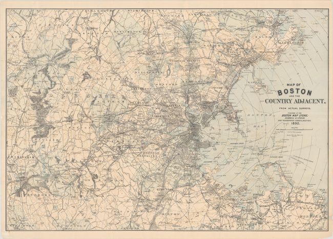
Subject: Boston, Massachusetts
Period: 1892 (dated)
Publication:
Color: Printed Color
Size:
35 x 24.3 inches
88.9 x 61.7 cm
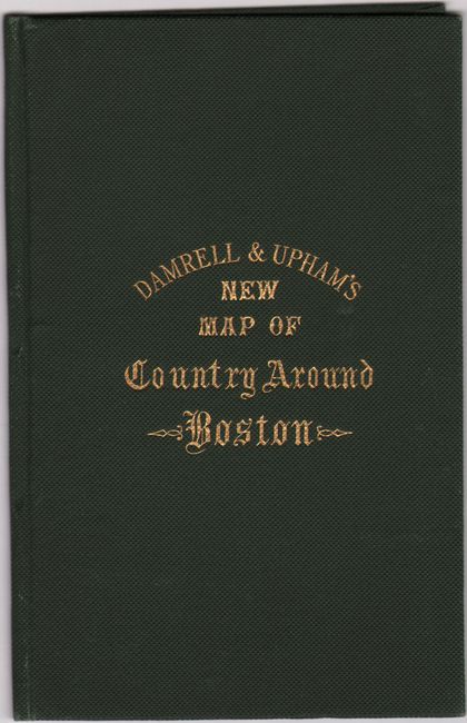
This pocket map details the region surrounding Boston from Cohasset north to Marblehead and west to include Concord and Framingham. Concentric circles are spaced at one mile intervals from the Boston post office. The map is filled with detail including railroads, wagon roads, post offices, and the major streets of larger towns including Boston, Roxbury and Chelsea. Drawn on a scale of one mile per inch. Published by Damrell & Upham for the Boston Map Store. Accompanied by the original green cloth covers with gilt title on the front cover.
References:
Condition: B+
Issued folding and now flat with numerous skillfully repaired fold separations on verso. There is minute loss in a couple of spots, most notably through the second "D" of Middlesex. Covers are near fine.