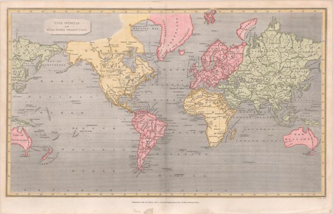
Subject: World
Period: 1807 (dated)
Publication:
Color: Hand Color
Size:
16 x 9.5 inches
40.6 x 24.1 cm
This world map on Mercator's projection is centered on the Atlantic Ocean and excludes both polar regions. The Pacific Northwest and much of Canada, Africa, and Australia is largely blank. An unusual feature of the map is that portions of Australia and Asia are redundantly shown at left and right with slightly different configurations; for instance, Jesso is shown both as an archipelago and a vaguely defined coastline, and the Sea of Japan is also identified as the G. of Corea. Engraved by John Lodge. Published by Longman, Hurst, Rees & Orme. An essentially identical map, engraved by Gideon Fairman, was published in Abraham Rees' The Cyclopaedia, or Universal Dictionary… (ca. 1806).
References:
Condition: A
There are a few faint spots in map image.