Subject: Ohio
Period: 1822 (circa)
Publication: A Complete Historical, Chronological, and Geographical American Atlas
Color: Hand Color
Size:
9.7 x 12 inches
24.6 x 30.5 cm
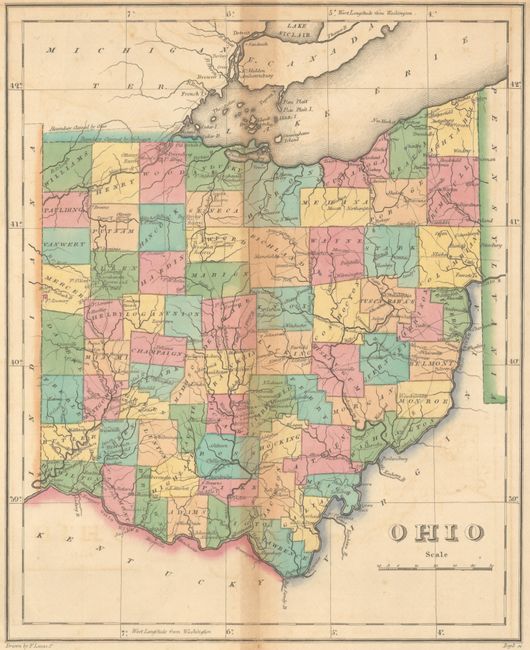
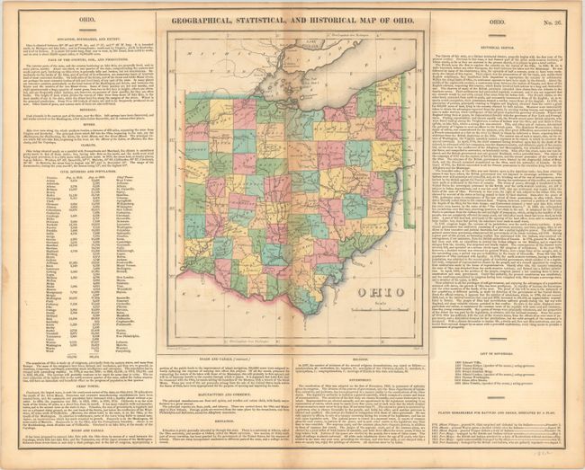
This early map of Ohio is on a full folio sheet (22.0 x 17.6") with flanked English text concerning the state's topography, climate, population, history, and other fascinating information. The locations of several battles and sieges are indicated with flags, with a few concentrated around Fort Meigs. Indian reservations are marked throughout the state with dotted lines. The disputed Toledo Strip appears in between Ohio and Michigan's border claims. Population chart of counties in 1810 and 1820 shows the rapidly increasing emigration of the period. There are only a couple of roads shown, with most of the state connected by trails. Drawn by Fielding Lucas, Jr. and engraved by Boyd.
References:
Condition: B
Contemporary color with some toning along the centerfold and faint offsetting in the map. A couple of short edge tears confined to the bottom blank margin have been closed on verso with archival tape.