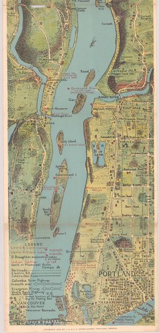
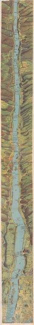
Subject: Columbia River, Oregon
Period: 1924 (dated)
Publication:
Color: Printed Color
Size:
6.3 x 64 inches
16 x 162.6 cm
This strip map of the Columbia River is oriented with east at the top and stretches from Portland to Rowena. There is incredible detail of both the river and the riverbanks, with particular attention to Lewis and Clark campsites, Native American nomenclature, auto camps, roads and railroads. The map is printed on two sheets, joined and folded as issued. The upper-most folded section (about 4") is missing, which extended the map to The Dalles. The map was originally issued in a Penland Guide booklet, but the booklet is not present with this example. Published by J. H. and H. F. Oppenlander. This map is quite rare, with only a few institutional holdings.
References:
Condition: B
Issued folding, with light soiling and 4 fold separations. The top portion (about 4" long) is missing in this example.