Subject: Portland, Oregon
Period: 1945 (dated)
Publication:
Color: Printed Color
Size:
23.3 x 20.6 inches
59.2 x 52.3 cm
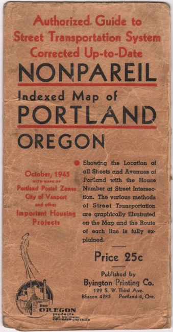
This detailed map of Portland presents the street grid pattern with city limits highlighted in red overprinting. A legend further identifies street car lines, electric coaches, and motor coaches. Concentric circles radiate from downtown in 1-mile increments. Interestingly, the map notes the base line which was the "Initial Point Public Surveys in Oregon & Washington" to the southwest of Macleay Park. A street index and related text fills the verso. Published by Byington Printing Company. Accompanied by paper envelope with title "Nonpareil Indexed Map of Portland Oregon." Price 25 cents.
References:
Condition: B
Issued folding with several short splits mostly at the fold junctions with some minute loss of image. There are a few ink notations below the top border and one circled location in the map. Accompanying paper envelope is worn and soiled with some pencil notations on the back.