Subject: Pennsylvania
Period: 1780 (published)
Publication: Universal Magazine
Color: Black & White
Size:
12.9 x 10.8 inches
32.8 x 27.4 cm
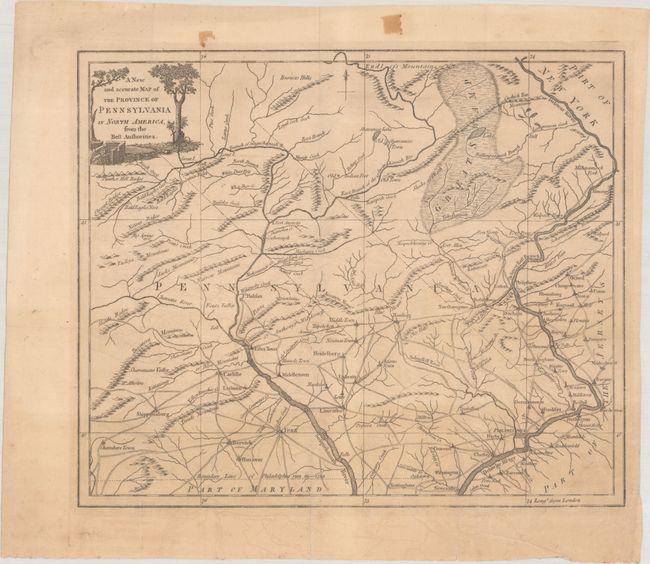
During the Revolutionary War, British periodicals published maps designed to familiarize magazine readers with the location of the hostilities overseas. This handsome and uncommon map illustrates the region that had been at the heart of the conflict during the Pennsylvania Campaign. It provides a good picture of the settlements and roads as well as topography. The map extends as far west as Chambers Town in Pennsylvania and includes part of New Jersey. The Boundary Line of Philadelphia run in 1739 divides Pennsylvania from Maryland. The decorative title cartouche features a fort and cannon.
References: Jolly #UNIV-185; Sellers & Van Ee #1298.
Condition: B+
Issued folding on a sheet with a coat of arms watermark and light offsetting. There is minor extraneous creasing at bottom right and a couple tape stains confined to the top blank margin.