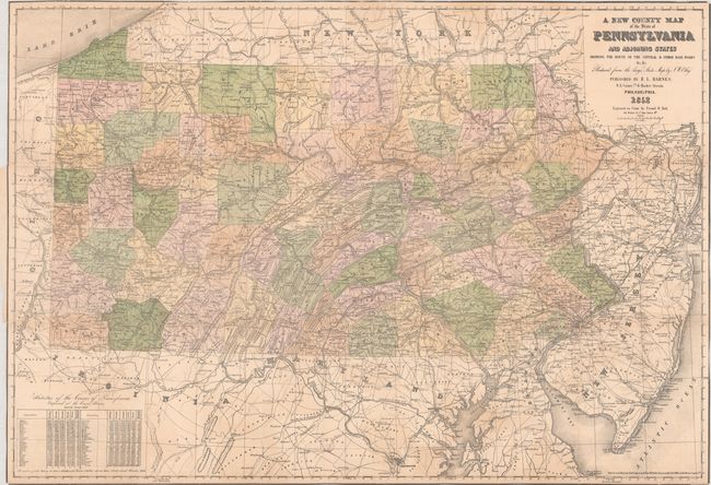
Subject: Pennsylvania
Period: 1852 (dated)
Publication:
Color: Hand Color
Size:
37 x 25.6 inches
94 x 65 cm
This large pocket map of the state is reduced from an earlier map by J.W. Otley and engraved on stone by Friend & Aub in Philadelphia. The rapidly evolving railroad network is the focus of this map with lines extending to Washington DC, Baltimore, and New York. Locates the Central Railroad, Ohio & Pennsylvania, Baltimore & Ohio, Winchester & Potomac, and many more. County configurations are current to the date of the map, which also shows numerous towns and cities, elevation by hachure, and the river systems. Includes population statistics from the 1850 census in the lower left corner. Lacking covers. First edition.
References:
Condition: B
Issued folding with contemporary color and some light staining. There are archival repairs to a 2.5" edge tear at left and numerous short fold separations, with minor loss along a couple of folds . Trimmed to the border all around.