Subject: Texas & Oklahoma
Period: 1919 (dated)
Publication:
Color: Printed Color
Size:
26.4 x 31 inches
67.1 x 78.7 cm
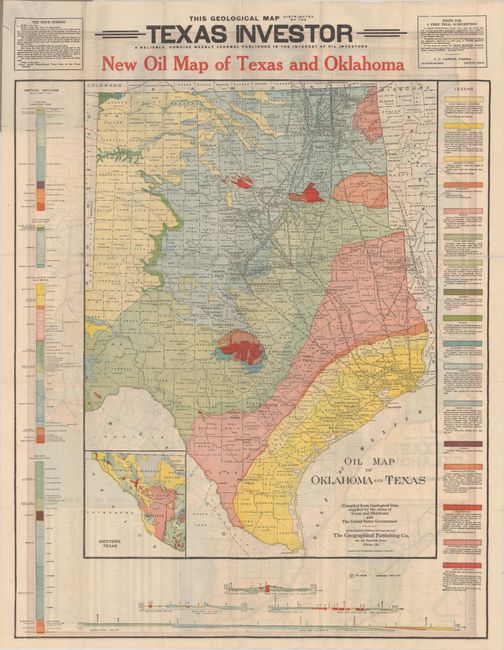
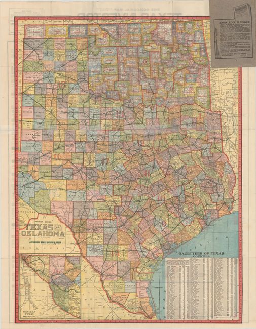
This large and very colorful oil map covers the entire state to include all of the panhandle, with the western portion in a large inset. It was produced by the Geographical Publishing Company and published here by C.C. Cannan, editor of the Texas Investor. It names all oil fields, the course of early oil pipelines, counties and watershed. Bold color and line identifies seventeen different geological types. The map represents a remarkable and scarce record of the state of the oil industry just after the close of World War I. On the verso is Premier Series Texas And Oklahoma, which uses green overprinting to show early "Automobile Roads" in the state.
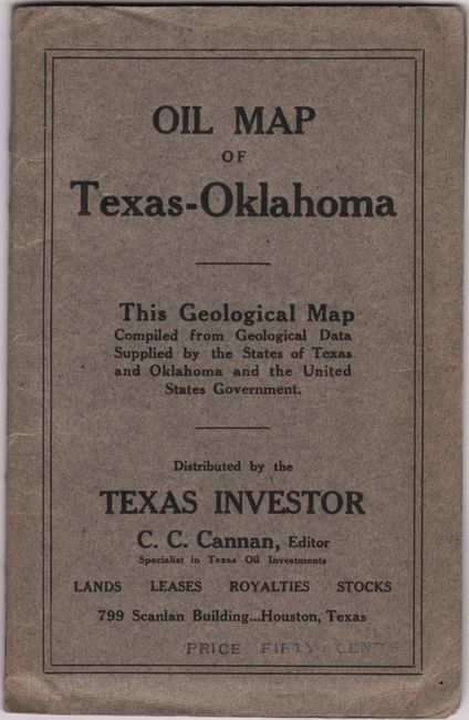
The map folds into paper wrappers with the rear wrapper showing a gushing oil well and promotional text praising Cannan as “a man who lived in Texas all his life—a practical, experienced OIL operator who KNOWS THE GAME, KNOWS THE OIL FIELDS and who KNOWS a good investment from a poor one.” Cannan was later convicted of selling shares of the Texas Royalty Syndicate and converting the money for his own use. The indictment involved three companies he operated and indicated he had organized six major companies and thirty syndicates between 1916 and 1924.
References:
Condition: B+
Clean and colorful with a number of short fold separations skillfully closed on verso map with archival tape.