Subject: Texas
Period: 1872 (circa)
Publication: Atlas of the United States
Color: Hand Color
Size:
17.3 x 14.1 inches
43.9 x 35.8 cm
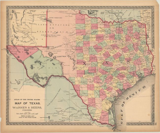
This map features counties in full contemporary color and presents the network of wagon roads, existing and proposed railways, watersheds, the U.S. Mail Route, and more. County seats are located and named, and each contains their date of incorporation, an uncommon feature for maps of this period. West Texas is made up of the huge Young Territory and the counties of El Paso and Presidio. The panhandle and part of New Mexico is the Llano Estacado or Staked Plain, which bears the notation "An elevated Barren Table Land destitute of Water, Wood and Grass." The map extends to include a portion of New Mexico and Indian Territory. Published by H.H. Lloyd & Co., and surrounded by a decorative period border.
References:
Condition: B+
Contemporary color on a lightly toned sheet with two small stains at bottom right. There are a couple of small chips and short archivally repaired edge tears all confined to the margins.