Subject: Eastern Texas
Period: 1930 (circa)
Publication:
Color: Hand Color
Size:
23 x 14.5 inches
58.4 x 36.8 cm
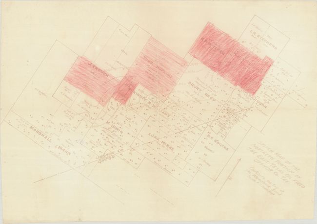
This map covers the northern portion of the East Texas Oil Field along the Gregg/Upshur County line. It shows property owners, various oil companies, and over 100 oil wells on a section of land measuring a little over 4 miles wide by 2 miles long. Contour lines running across the map indicate the "Woodbine Sand," a highly productive part of the oil field. It is unclear what the colored areas represent, but given the location of current wells, it could be areas identified for future drilling. The East Texas Oil Field is the second largest oil field in the United States outside of Alaska.
References:
Condition: B+
Issued folding with some minor crinkling at top and bottom and a short archivally repaired fold separation at left.