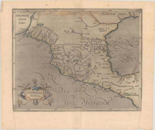
Subject: Southern United States & Mexico
Period: 1597 (circa)
Publication: Descriptionis Ptolemaicae Augmentum
Color: Hand Color
Size:
11.3 x 9 inches
28.7 x 22.9 cm
This is one of the earliest maps of the American Southwest and Mexico, including the southern part of present-day Texas, here called Floridae Pars, with the Rio Grande, labeled R. de Palmas. The map concentrates on the Spanish area of influence and is one of nineteen regional maps of the Americas contained in Wytfliet's atlas, which was the first devoted exclusively to the New World. Stipple engraved seas, calligraphy, and a decorative title cartouche adorn the map.
References: Burden #105; Mickwitz & Miekkavaara #307-12; Shirley (BL Atlases) T.WYT-1a.
Condition: B
A dark impression on a sheet with a fleur-de-lis watermark. There are a few printer's creases, printer's ink residue, and some stains along the top of the map image.