Subject: Southern United States & Mexico, Texas
Period: 1842 (circa)
Publication: Black's General Atlas...
Color: Hand Color
Size:
14.6 x 10.3 inches
37.1 x 26.2 cm
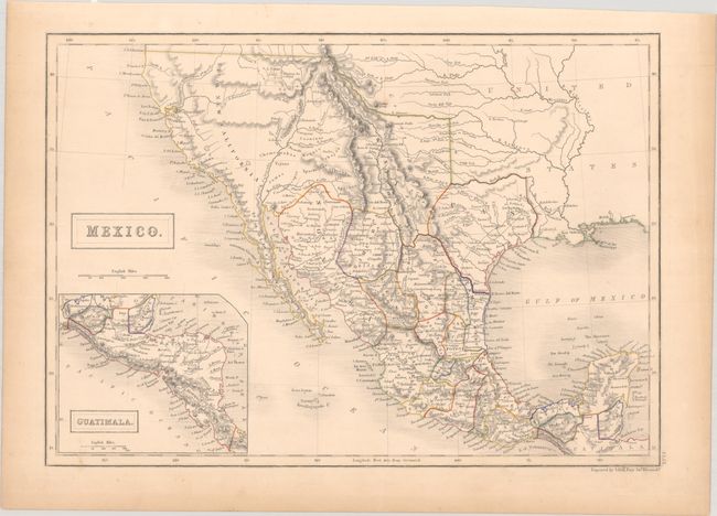
This attractive map illustrates present-day southwestern United States, Texas, and Mexico. It shows the Independent Republic of Texas in its largest extent bound by the Rio Grande and extending north into present-day Colorado. Interestingly, the colorist has not followed the engraved lines for Texas with colored boundaries suggesting a small Republic of Texas (only X-A-S of Texas appears in this region). In Upper or New California, there is an American Fur Co. Depot on the eastern shore of L. Youta or Salt L.. In New Mexico, the Great Spanish Road is shown from the Red River on the Texas boundary to Santa Fe, and then heading south through the length of Mexico. The map continues into Central America in an inset of Guatimala. The Great Basin shows pre-Fremont information with numerous rivers including the River Buenaventura which runs straight through on its way to the Pacific Ocean.
References:
Condition: B+
Contemporary outline color on a lightly toned sheet.