Catalog Archive
Auction 202, Lot 270
First Edition, First State of Kino's Map
"Passage par Terre a la Californie Decouvert par le Rev. Pere Eusebe-Francois Kino Jesuite Depuis 1698 Jusqu'a 1701 ou l'on voit Encore les Nouvelles Missions des PP. de la Compage. de Jesus", Kino, Eusebio Francisco, SJ
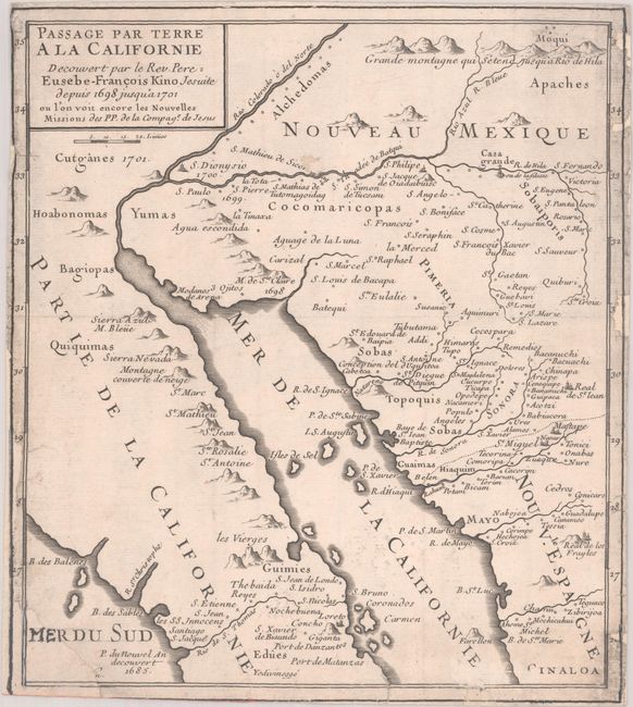
Subject: Southwestern United States & Mexico, California
Period: 1705 (published)
Publication:
Color: Black & White
Size:
8.3 x 9.4 inches
21.1 x 23.9 cm
Download High Resolution Image
(or just click on image to launch the Zoom viewer)
(or just click on image to launch the Zoom viewer)