Subject: Veracruz, Mexico
Period: 1756-64 (circa)
Publication:
Color: Hand Color
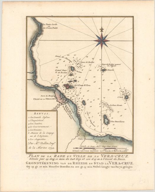
A. Plan de la Rade et Ville de la Vera-Cruz... / Grondtekening van de Rheede en Stad la Vera-Cruz..., from Histoire Generale des Voyages, dated 1754 (6.1 x 7.8"). This attractive copper engraved chart details the fortified city of Veracruz and surroundings including the Fort de St. Jean d'Ulua. Outside of the fortified walls are the Redoute de la Galette, Chapelle de St. Sebastien, and the Chapelle de Christ. Seven important features are named and keyed to the map. Soundings and sailing hazards are noted in the bay. Southeast of Veracruz is the Petits Ruisseaux. Large compass rose with rhumblines. Engraved by Van der Schley.
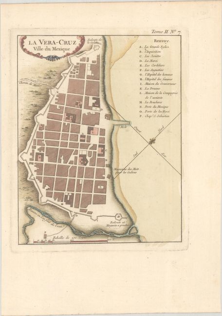
B. La Vera-Cruz Ville du Mexique, from Le Petit Atlas Maritime, published 1764 (6.6 x 8.4"). This finely rendered plan view of Veracruz includes excellent detail of the city's fortifications. A key at top right identifies 15 locations of interest, including the main cathedral, the governor's mansion, the customs house, and the butchery. A fleur-de-lis orients north to the top left. The title is contained by an ornate cartouche.
References:
Condition: A
Crisp impressions on watermarked paper.