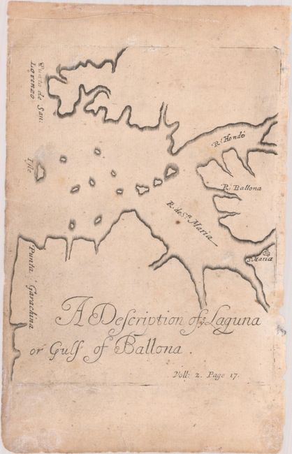
Subject: Bay of San Miguel, Panama
Period: 1695 (circa)
Publication: The History of the Bucaniers of America
Color: Black & White
Size:
4.5 x 5.7 inches
11.4 x 14.5 cm
This simple and striking map of the Bay of San Miguel was drawn on April 19, 1680 by Basil Ringrose, the English buccanneer, navigator, and geographer who accompanied Captain Bartholomew Sharp across the Isthmus of Darien. It was first published in 1684 in the fourth volume of Esquemeling's The History of the Bucaniers of America; this is the second state, published between 1695-1704, as distinguished by the addition of "Voll: 2. Page 17" at bottom right.
References: Kapp (MCC-73) #21; Sabin #23483.
Condition: B+
On a lightly toned sheet with light soiling, a few spots of foxing, and a short edge tear at left that has been closed on verso with archival tape. Narrow side margins, as issued, with a few tiny chips in the right margin.