Subject: Gulf of Mexico & Caribbean, Texas
Period: 1840 (circa)
Publication:
Color: Hand Color
Size:
22.9 x 14.4 inches
58.2 x 36.6 cm
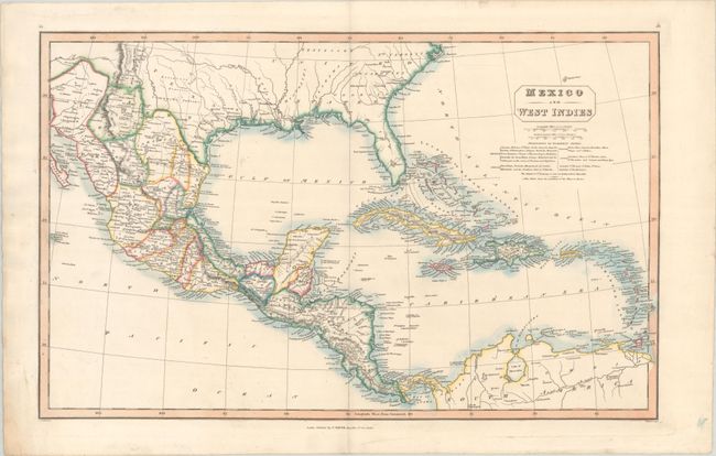
This handsome map is color-coded to show the colonial possessions of the British, French, Spanish, Dutch, Danish and Swedish in the Caribbean. It extends north of the Gulf of Mexico to depict the majority of the Republic of Texas, and names Houston, Galveston, Austin, Bexar (San Antonio), and Laredo. Further south, the map delineates the Mexican states and extends to incorporate northern South America. Filled with details including coastal place names, roads, topography, and drainage. Published by Charles Smith at No. 172, Strand, London.
References:
Condition: A
Issued on "T.Edmonds.Wyoombe" watermarked paper with some minor creasing in the margins.