Subject: Cuba
Period: 1747 (circa)
Publication: A Complete System of Geography
Color: Hand Color
Size:
16.6 x 7.1 inches
42.2 x 18 cm
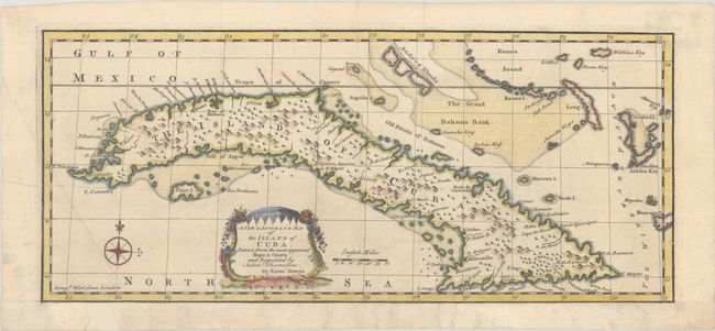
This detailed and beautifully engraved map of Cuba originally appeared on the same sheet as Bowen's map of Hispaniola and Puerto Rico. Numerous places are named along the coastline, including Havana, Santiago de Cuba, and Manzanillo, and there is good detail of shoals and rocks to assist in navigation. It extends to show Exuma Sound and the Grand Bahama Bank. The map is graced by a charming rococo-style cartouche and a compass rose.
References: McCorkle (18th c. Geography Books) #17-35 (Vol II); Shirley (BL Atlases) T.BOW-2a #65.1.
Condition: B+
A crisp impression, issued folding and now flat, on a sheet that has been remargined at bottom with old paper, with the neatline replaced in facsimile. There is a printer's crease and minor extraneous crease at left, and an old tape stain is visible at upper right (tape on verso has since been removed).