Subject: Jamaica
Period: 1770 (circa)
Publication: The English Pilot, Fourth Book
Color: Hand Color
Size:
26.8 x 18 inches
68.1 x 45.7 cm
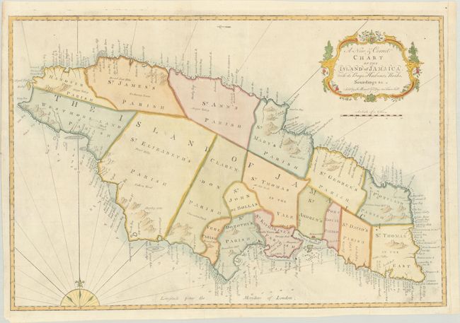
This finely engraved map of Jamaica is primarily focused on coastal features with harbors, bays, shoals, anchorages and landmarks all carefully located. It also shows the parishes, towns forts and major topographical features. Trelawny Parish is not shown, but Trelawny Town is noted. The cultivation of sugar cane and coffee made Jamaica one of Britain's most valuable possessions. It was also the site of several major slave uprisings throughout much of the 18th century and the British were constantly harassed by the Maroons, armed bands of freed slaves roaming the countryside.
References: Sellers & Van Ee #1922; Shirley (BL Atlases) M.M&P-5h #17.
Condition: B+
Issued folding and now flat with a fleur-de-lis watermark. There are professional repairs to several small fold separations and a couple of tears including a 4" tear at left. The right side margin has been extended with old paper.