Catalog Archive
Auction 202, Lot 310

"Ville de S. Domingue dans l'Isle de ce Nom", Bellin, Jacques Nicolas

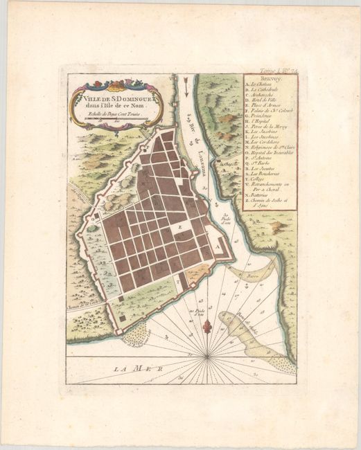
Subject: Santo Domingo, Hispaniola

Period: 1764 (published)

Publication: Le Petit Atlas Maritime

Color: Hand Color

Size:
6.4 x 8.7 inches
16.3 x 22.1 cm
Download High Resolution Image
(or just click on image to launch the Zoom viewer)

This is a very nice street plan of Santo Domingo, the present-day capital of the Dominican Republic. A legend indicates the location of 22 significant features on the map. Anchorages and soundings are shown. The chart is embellished with rococo-style cartouche, rhumb lines, and fleur-de-lys. Santo Domingo is the oldest continually inhabited European settlement in the Americas, and was at the time of this map's publication a Spanish colonial possession.

References:

Condition: A

There is minor foxing that is mostly confined to the blank margins.

Estimate: $150 - $180

Sold for: $110

Closed on 2/12/2025

Archived