Subject: Lesser Antilles
Period: 1777 (published)
Publication: Geschichte der Mission der Evangelischen Bruder auf den Caraibischen…
Color: Hand Color
Size:
13.8 x 12.1 inches
35.1 x 30.7 cm
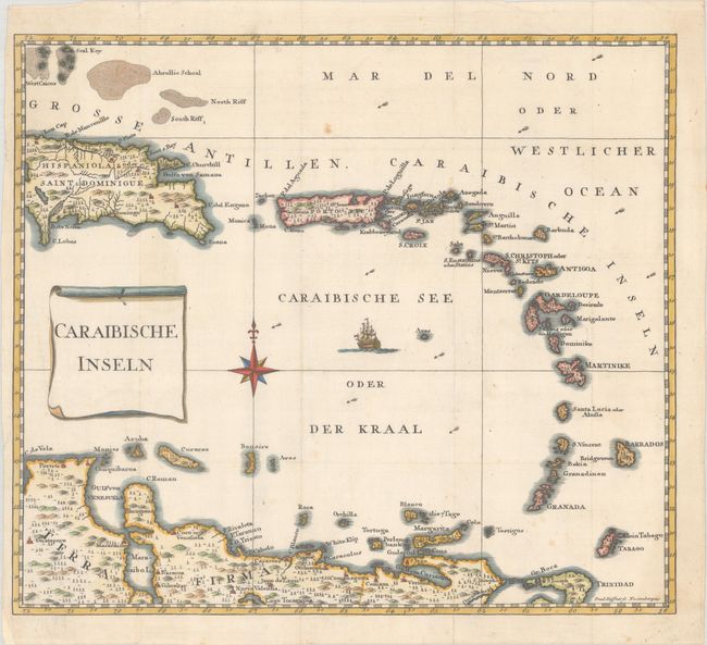
This scarce map was published in the second part of Oldendorp's Geschichte der Mission der Evangelischen Brueder auf den Caraibischen Inseln St. Thomas, St. Croix, St. Jan… or a History of the Evangelical Brethren on the Caribbean Islands of St. Thomas, St. Croix and St. John. The book is considered the first published work detailing the history, resources, and social conditions in the Danish West Indies, today's Virgin Islands. The map details the islands from most of Hispaniola through Puerto Rico, the Virgin Islands, and down the Windward and Leeward Islands to include Trinidad and Tobago. The map is embellished with a compass rose and scroll-style title cartouche. Engraved by Kuffner in Nuremberg.
References:
Condition: A
A fine impression, issued folding and now pressed, on paper with an "IGO" watermark. The folds have been reinforced on verso with archival material and there are a few minor spots.