Subject: Barbados
Period: 1862 (dated)
Publication:
Color: Black & White
Size:
19.1 x 24.3 inches
48.5 x 61.7 cm
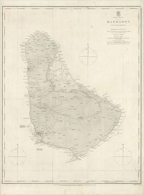
This map of Barbados is based in part on William Mayo's survey of the island some 100 years earlier. The first Admiralty chart of the island appeared in 1828, with a subsequent edition in 1856. In the waters, there is good navigational detail around Carlisle Bay and Oisting Bay with soundings, shoals, anchorages, and lighthouses identified. The towns of St. Michaels and Speights Town are shown in plan format, and numerous individual buildings are depicted including churches, forts, hospitals, houses, and more. Mountains, elevation and the river systems are well rendered in the interior. In 1873 the Admiralty would take on an entirely new survey, finally replacing Mayo's survey as the standard for Barbados maps. Published in 1856 with corrections to 1862. Engraved by J. & C. Walker.
References: Campbell (MCC-21) #59.
Condition: B+
On watermarked paper with some minor soiling and an archivally repaired 5.5" edge tear at top.