Subject: World
Period: 1942 (dated)
Publication:
Color: Printed Color
Size:
35.5 x 14.9 inches
90.2 x 37.8 cm
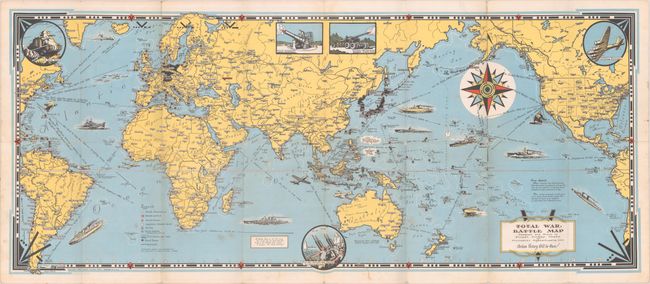
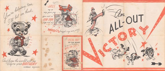
This elaborate wartime map centered on the Pacific theater of war was created by Ernest Dudley Chase (1878-1966), one of the leading figures in pictorial mapmaking during the middle 20th century. It locates numerous Allied naval bases, railroads, British & French colonial possessions, and the Axis power countries in menacing black. (Curiously, Fascist Italy does not appear in Axis black, despite the fact that the map predates the armistice in September 1943.) The oceans are filled with illustrations of Allied military power including ships, submarines, and aircraft with distances between various ports noted. Illustrations along the border feature "A Yank Tank," "Flying Fortress," and "New Anti Aircraft Gun Mounts by Westinghouse." Chase describes his production as "A Battle Map, to set the stage for 'total war' on land and sea; And, in the border, just a hint - A prayer - for total Victory!" This is an early birthday card issue of the map with cartoonish illustrations on verso showing a patriotic bear observing the war via the map and a stirring image of Uncle Sam delivering a pants-splitting kick to the behinds of the Axis leaders. Issued by Rust Craft Publishers in Boston, a greeting card company founded by Chase. Self-folding into pictorial wrappers (4.6 x 8.0").
References: Curtis & Pedersen (War Map) pp. 154-57; Hornsby (Picturing America) pp. 31-34; cf. Rumsey #8527.
Condition: B
A bright example, issued folding. There are a few spots of soiling and several small splits at the fold junctions with some minor loss of image.