Subject: Eastern Brazil
Period: 1698 (published)
Publication: Istoria delle Guerre del Regno del Brasile
Color: Hand Color
Size:
19.9 x 14.8 inches
50.5 x 37.6 cm
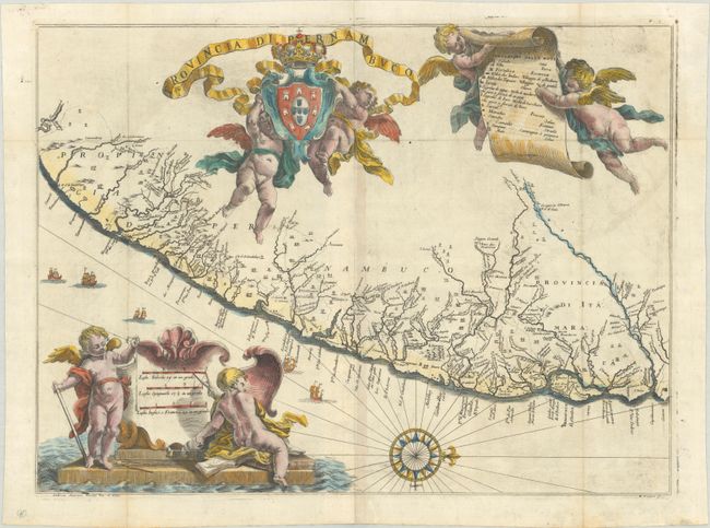
This superb map of the Brazilian province of Pernambuco was one of 23 maps from this rare account of the Dutch-Portuguese colonial war. Written by Joao José de Santa Teresa, and known among bibliophiles as the Santa Teresa, it is considered one of the most sumptuous 17th century works on Brazil. Santa Teresa, a Portuguese Carmelite, spent twelve years in the Jesuit missions of South America and then returned to Europe where he became librarian of the college of the Jesuits in Rome. His account was heavily subsidized by Pedro II of Portugal, and some of the period's leading artists and engravers, including Antonio Horacio Andreas, were engaged to work on the project. It was published by Giacomo Giovanni Rossi. The map itself is beautifully drawn and provides an excellent view of the region with rivers and streams carefully delineated. The locations of villages, missions and forts are recorded, including Olinda. Even the navigational hazards are shown along the coastline. A large compass rose orients the map with north to the right. The map is elaborately adorned with putti supporting the title cartouche, royal coat of arms, and the key to the map.
References:
Condition: B+
A crisp impression, issued folding on a sheet with a Pascal lamb watermark and faint offsetting. The paper is lightly cockled and spots of sizing are visible only when held to the light at the right angle.