Subject: Peru
Period: 1639 (circa)
Publication:
Color: Hand Color
Size:
19.3 x 14.9 inches
49 x 37.8 cm
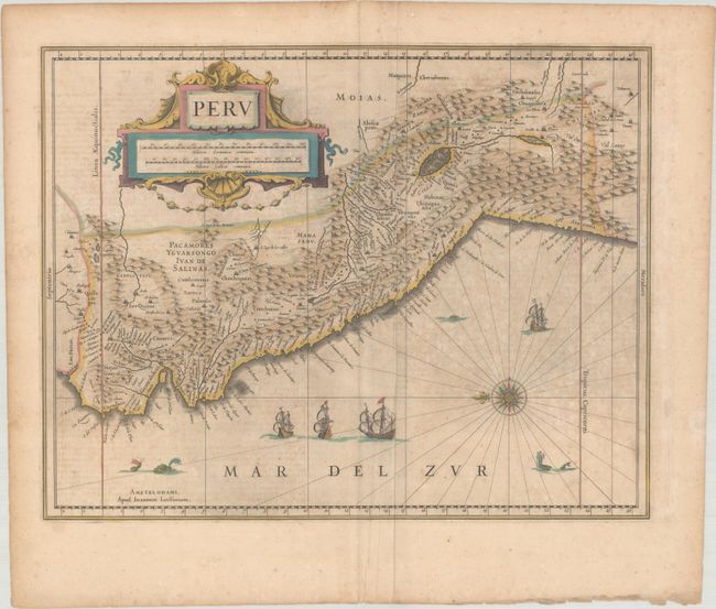
A large compass rose orients north to the left on this map of the Empire of Peru. It covers the Pacific coast of South America from Ecuador as far south as the Atacama Desert in the northern reaches of Chile. It includes the Potosi silver mines, Titicaca, Cusco, Quito, and numerous other towns and villages. The large cartouche incorporates both the title and the distance scales and is decorated with sea shells. The sheet is further decorated with four Spanish galleons and three sea monsters. This map is one of the many similar maps that were produced by Jansson and Blaeu. French text on verso, published between 1639-49 in either Nouveau Theatre du Monde or Nouveau Atlas ou Theatre du Monde.
References: Van der Krogt (Vol. I) #9820:1.
Condition: B
Full contemporary color on a lightly toned sheet with moderate foxing, a few extraneous vertical creases, and minor color offsetting. There are small chips and short edge tears that are confined to the edges of the sheet.